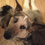
We hiked our most common walk today at Chabot Regional Park. The walk heads South along a ridge from a parking area to a path that goes steeply downhill to a fairly level trail above a stream. That leads to a trail wide enough to drive on, basically a fire road that climbs back up to the parking area. Just over two miles.
Lia coming up the fire road at the end.
![[Image: 11575451366_b78239f6c5_z.jpg]](https://images.weserv.nl/?url=farm4.staticflickr.com%2F3815%2F11575451366_b78239f6c5_z.jpg)
Heidi nosing around some trees on the way up the hill.
![[Image: 11574685385_a05011c227_z.jpg]](https://images.weserv.nl/?url=farm4.staticflickr.com%2F3721%2F11574685385_a05011c227_z.jpg)
The path above the creek.
![[Image: 11575473416_06c32b9f67_z.jpg]](https://images.weserv.nl/?url=farm4.staticflickr.com%2F3773%2F11575473416_06c32b9f67_z.jpg)
Instead of avoiding the power lines, today I looked for angles which made them more photogenic.
![[Image: 11574696395_0cc5a66c0d_z.jpg]](https://images.weserv.nl/?url=farm6.staticflickr.com%2F5478%2F11574696395_0cc5a66c0d_z.jpg)
Starting off along the ridge South. The path along the creek is down in the canyon below.
![[Image: 11575032694_39384ac0df_z.jpg]](https://images.weserv.nl/?url=farm3.staticflickr.com%2F2846%2F11575032694_39384ac0df_z.jpg)
The fire road coming up the hill at the end.
![[Image: 11574894533_74db6da9e4_z.jpg]](https://images.weserv.nl/?url=farm6.staticflickr.com%2F5534%2F11574894533_74db6da9e4_z.jpg)


